

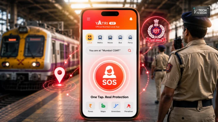
Yatri, the official mobile application for Mumbai’s suburban railway network, has introduced a dedicated SOS feature designed to improve safety for women commuters. Developed in partnership with Central Railway and the Railway Protection Force (RPF), the tool allows users to transmit their precise location and train details to authorities with a single tap.
How Yatri’s SOS Feature Improves Emergency Response
The primary objective of this integration is to minimize the time responders spend searching for a commuter in distress. By automating the transmission of live location data and specific train information, the system provides RPF personnel with the necessary context to reach individuals more efficiently.
The development process involved over 10 months of testing and collaboration with RPF officials. This period allowed the team to refine the feature against various real-world emergency scenarios, ensuring that the technology aligns with established railway response protocols.
Engineering and Geofencing Technology Behind the SOS Tool
The SOS functionality relies on a combination of geofencing and real-time operational intelligence. The system creates virtual boundaries around railway stations and the surrounding tracks, limiting the feature’s activation to areas within approximately 150 metres of the railway network.
Beyond simple GPS coordinates, the application maps the user’s location against the railway’s operational data. This allows the system to identify specific details such as:
- The direction of the train movement.
- Whether the commuter is on an Up or Down line.
- The specific service the user has boarded.
This technical architecture ensures that alerts are only generated from valid railway environments, which helps reduce misuse while keeping the focus on incidents where railway authorities can provide immediate intervention.
The Role of Yatri in Urban Mobility
Launched in 2021, Yatri serves as a comprehensive platform for public transport, offering GPS-based live tracking, real-time updates on train delays, and metro ticket booking. The app supports a multi-modal approach, covering buses, monorails, and ferries to assist commuters in planning end-to-end journeys.
The addition of the SOS feature reflects the company’s broader commitment to building a connected urban mobility ecosystem. By incorporating community-driven tools such as incident reporting and chat functions, the platform aims to make public transit more reliable and accessible for millions of daily passengers across its operational cities.
Significance for Commuter Safety
This initiative represents a practical application of technology to address the challenges of securing large-scale public infrastructure. By bridging the gap between digital location data and on-ground emergency response, the collaboration provides a scalable model for enhancing safety on public transit networks.
For commuters, the feature offers a streamlined method to seek help, while for authorities, it provides the actionable intelligence required to manage time-sensitive incidents effectively.